Let’s Talk Geography
Today I figured we would dive into one of my favorite things about this project: Maps!
I am what you could call a “fantasy map nerd,” which is a very specific and important kind of nerd. I’m the person who gets giddy at seeing a detailed map at the beginning of a book, because I know that a rich story is about to unfold. If an author thinks deeply enough about their work to have specific location information ready at the front of their mind when telling the story, detailed enough to draw it all out, the pang of the locale sharp enough to want readers to know exactly where a story takes place… It’s like catnip. Nom nom.
Hence, when I first started telling this story two decades ago, I drew a map.
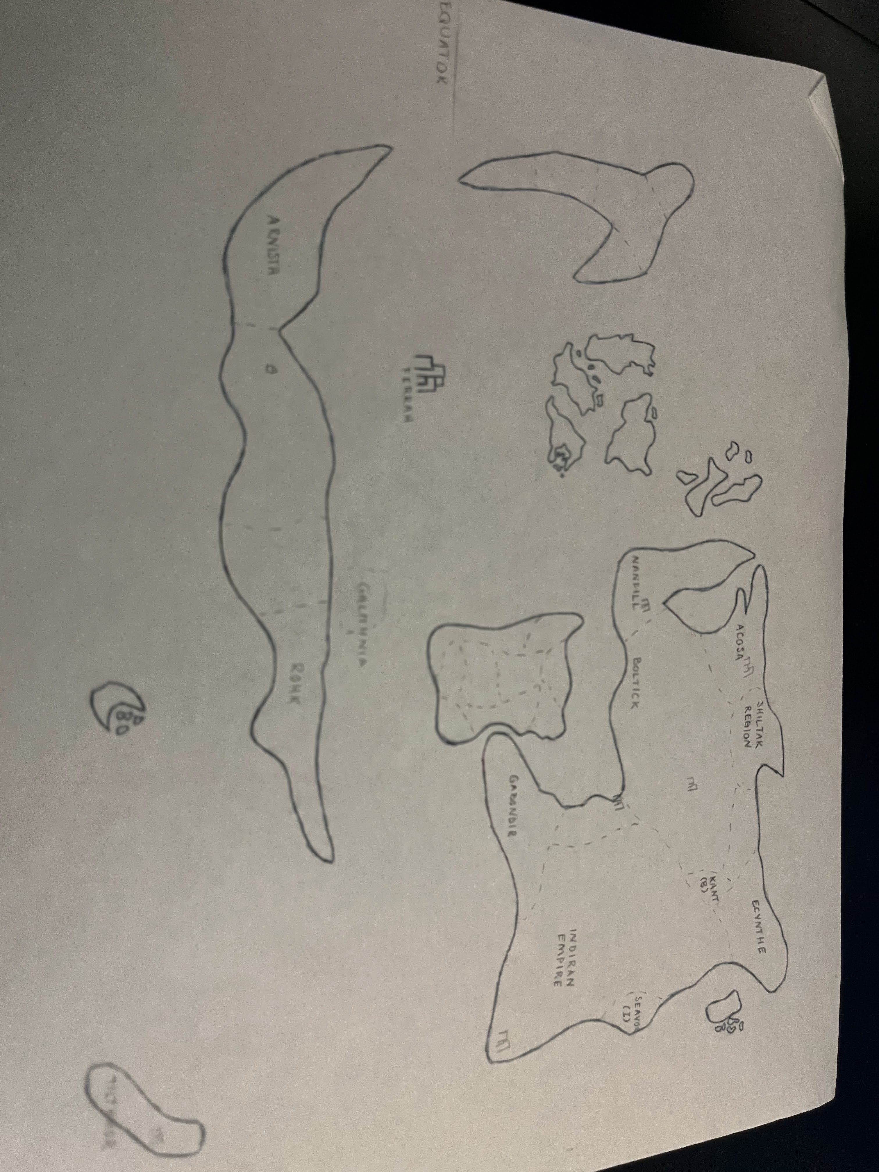
At first, it was not very detailed, or proportional, or really that interesting. But as I drew the map again and again, using first notebook paper and then dot matrix paper and then printer paper, quirks emerged, little mysteries that I wanted to explore. Each time, it was different. For instance, one day, a city appeared in the middle of the ocean. Then a group of islands above it. Then a city in the very northeast of the large eastern continent. What are these places? What secrets could they hold?
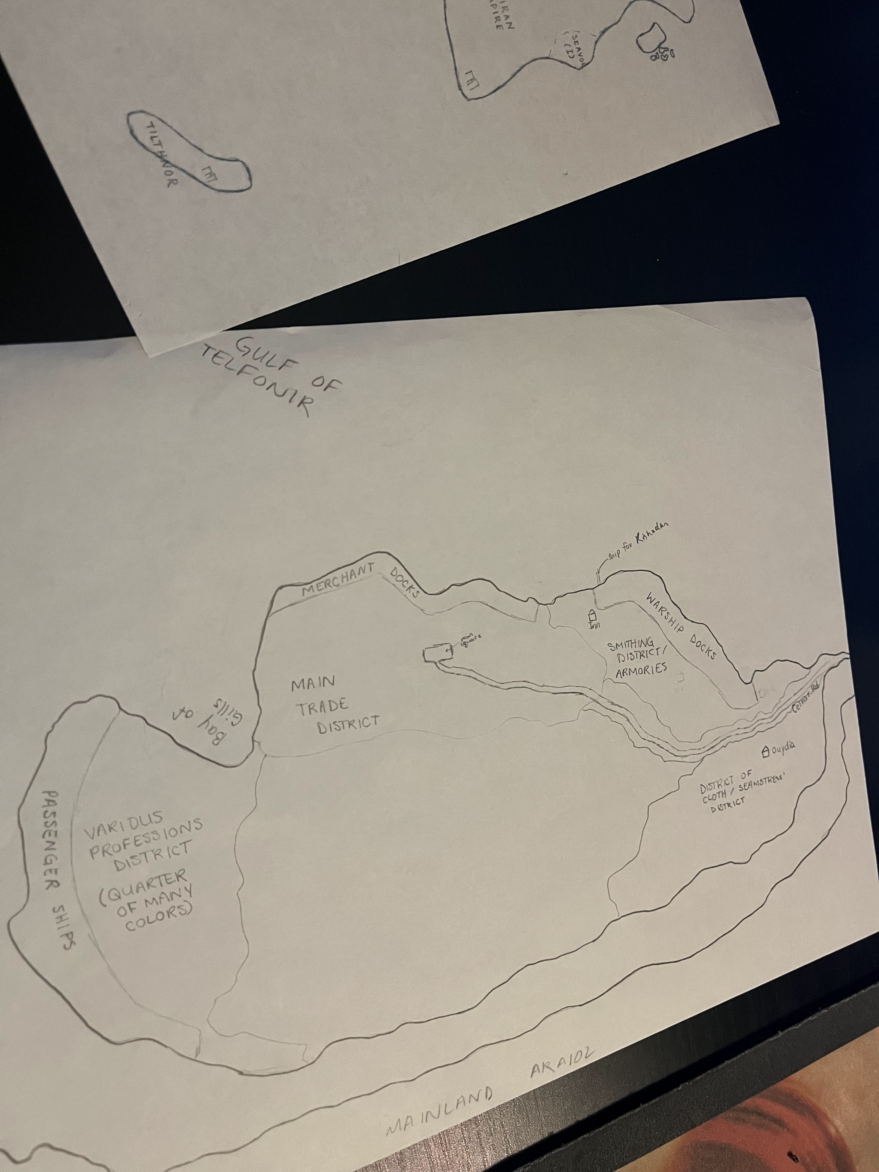
Slowly, the maps became more intricate. The piece to the right depicts a port city called Gralth, which is situated on a peninsula and surrounded on three sides by ocean. The gang spends a decent amount of time here in the middle part of my book. It’s a huge, bustling city — the gateway to the continent for everything to the west. Gralth began as a simple trading post, distinctly positioned on the peninsula between the mouth of a river and the open ocean, but quickly became the pinnacle of industry. Structures made from wood and steel reach into the sky, defying man and magic with their height and glimmer. The markets sing with voices and wares from across the world. People from every background, every race, every level of magical ability find their way here.
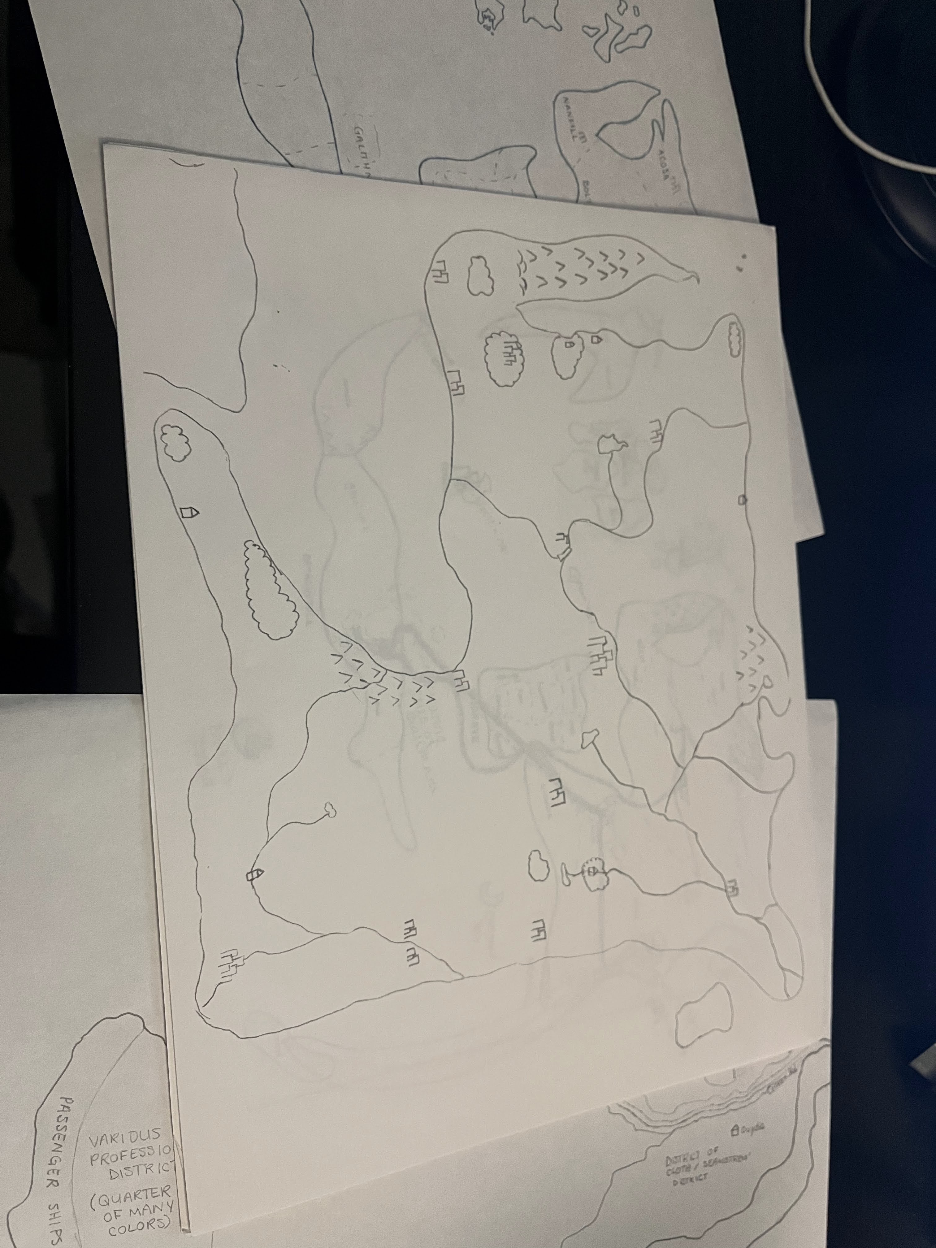
Finding this map in my stack of old papers last week was nothing short of a miracle. There are specifics here! Place names, and neighborhoods, and geographical marks. I was already excited for NaNoWriMo to start — but this makes it even better. And because it was so long ago that these maps were drawn, it’s almost like a stranger did it. Couldn’t have been me. So I’m getting to explore these places anew, with fresh eyes and fresh typing fingers.
Most of the first book in this series takes place here. This is the continent of Araiol. We start kind of in the center, in a city called Torryn, which is the capital of a country called Boltick. Eventually, the story follows the characters south, to Gralth, and then even further south, toward a different continent closer to the center of the plane. Heat rises from gritty earth… just as the kingdom of Galithnia rises from the land. Galithnia, the home of dragons, consists of several islands floating far, far above the ground. The people there wrap themselves in warm woolen shawls and thank the Goddess that they are removed enough from the mainland to not have to worry about the politics of those far below them.
Until their king and queen are murdered.
… And that’s all for now!

Leave a comment